Last update
2024
Summary
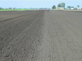
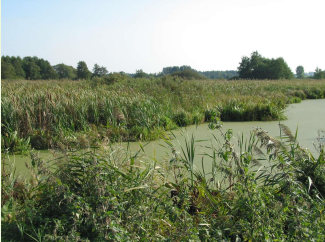
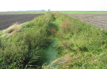
The case study is located in the north central Poland, in Kuyavian-Pomeranian province. The catchment area is about 150 km2. Due to highly fertile soils, arable land prevails (nearly 90%) in the catchment. The main crops are cereals, maize, oilseed rape, sugar beet, alfalfa, vegetables and herbal crops. An area covered by catch crops is increasing. Share of irrigated crops is small. The catchment is coping with an increasing water deficit for crop production and high nitrate loads and concentrations in water. These problems are amplified by low precipitation (annual average equals to 500 mm being the lowest in the country, 300 mm in the growing season) and the extensive drainage system (open ditches and subsurface tiles) that drains water excess in wet periods.
The OPTAIN project will support the case study team with identifying and developing efficient land management strategies and small technical solutions to improve the soils’ infiltration and water holding capacities as well as its capacity to filter, buffer and transform pollutants.
The OPTAIN project will support the case study team with identifying and developing efficient land management strategies and small technical solutions to improve the soils’ infiltration and water holding capacities as well as its capacity to filter, buffer and transform pollutants.
Latitude
52.65967
Longitude
19.05471
Project
Optain
National Id
PL_04
Photo gallery


Location of the project
The Zlowiaczka river basin is located in central Poland, western of Warsaw. The basin is characterized by a strong agricultural presence, with 90% of the land being arable, and only 4% forested.
Sponge Measure(s) implemented in the case study
OPTAIN's measures
Design Authority
| Authority type | Authority name | Role | Comments |
|---|---|---|---|
Site name
Upper Zglowiaczka River Basin
Light or indepth?
Light
Transboundary
0
Climate zone
cool temperate moist
Temperature
8,5
Mean annual rainfall
300 - 600 mm
Average slope range
flat (0 - 2%) to gentle (3 - 5%)
Depth groundwater
less than 5m
Design land use change
| Land use change type | Comment |
|---|---|
Contractual arrangements
0
Design contractual arrangement
| Arrangement type | Responsibility | Role | Name | Comments |
|---|---|---|---|---|
Financing
| Financing type | Authority name | Share | Comments |
|---|
Financing(old)
| Financing type | Comments | |
|---|---|---|
Financing share(old)
| Financing share type | Share | Comments | |
|---|---|---|---|
Community involvment
No
Design consultation activity
| Activity stage | Key issues | Name | Comments |
|---|---|---|---|
Policy target
| Target purpose |
|---|
Policy area
| Policy area type | Policy area focus | Name | Comments |
|---|---|---|---|
Wider plan type
| Wider plan type | Wider plan focus | Name | Comments |
|---|---|---|---|
Requirement directive
| Requirement directive | Specification |
|---|---|
Part of wider plan
0
Policy pressure
| Pressure directive | Relevant pressure |
|---|---|
Policy impact
| Impact directive | Relevant impact |
|---|---|
Success factor(s)
| Success factor type | Success factor role | Comments |
|---|---|---|
Driver
| Driver type | Driver role | Comments |
|---|---|---|
Key lessons
Surveys were carried out with stakeholders to better understand barriers and challenges to implementing NWRM in the agricultural sector. Of the 19 informants interviewed, all agreed that policy mechanisms were not adapted to resolving the environmental and water quantity concerns of stakeholders.
The following barriers to NWRM implementation were identified: administrative barriers, voluntary measures, low benefit-cost, complicated implementation, land ownership issues.
The following barriers to NWRM implementation were identified: administrative barriers, voluntary measures, low benefit-cost, complicated implementation, land ownership issues.
Financing mechanism
0
The in-depth description of the case study
Monitoring maintenance
Monitoring impacts effects
0