OPTAIN : Csorsza, Hungary
Last update
2024
Summary
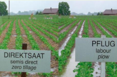
The Csorsza case study is located in Veszprém County, Hungary. The size of the study site is 21.3 km2, where 29% of the total catchment area is forest, 29% orchards and vineyards, 17% shrubs, 13% is arable land, 6% is grassland, and 5% is urban.
Some selected analysis are performed at the Felső-Válicka catchment, too. The Felső-Válicka study site is located in Zala County, flows in south-north direction into the River Zala. The size of the catchment is 131 km2. 27% of the total catchment area is forest, 35% is cropland, 11% is grassland, 3% is wetland and 11% is urban.
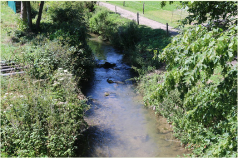
Both study sites are located in the catchment of Lake Balaton, therefore state of the environment and nature in these small catchments influences the touristic and economic potential of the Balaton region. Their water and nutrient management affects water quantity and quality of the lake. Extreme weather events will increase the environmental and social conflicts in the region.
Main challenges identified in both sites are decreasing soil erosion and nutrient load, preventing flash floods, and implementing integrated water resources conservation.
OPTAIN project aims to identify effective combination of the NSWRMs and optimize their allocation, in order to improve water and nutrient retention in the soil and the catchments. Emphasis will be put on suitable options to foster the resilience of agricultural production to climate change.
Some selected analysis are performed at the Felső-Válicka catchment, too. The Felső-Válicka study site is located in Zala County, flows in south-north direction into the River Zala. The size of the catchment is 131 km2. 27% of the total catchment area is forest, 35% is cropland, 11% is grassland, 3% is wetland and 11% is urban.
Both study sites are located in the catchment of Lake Balaton, therefore state of the environment and nature in these small catchments influences the touristic and economic potential of the Balaton region. Their water and nutrient management affects water quantity and quality of the lake. Extreme weather events will increase the environmental and social conflicts in the region.
Main challenges identified in both sites are decreasing soil erosion and nutrient load, preventing flash floods, and implementing integrated water resources conservation.
OPTAIN project aims to identify effective combination of the NSWRMs and optimize their allocation, in order to improve water and nutrient retention in the soil and the catchments. Emphasis will be put on suitable options to foster the resilience of agricultural production to climate change.
Latitude
46.90908
Longitude
17.67489
Project
Optain
National Id
HU_07
Photo gallery


Sponge Measure(s) implemented in the case study
OPTAIN's measures
Design Authority
| Authority type | Authority name | Role | Comments |
|---|---|---|---|
Site name
Csorsza, Hungary
Light or indepth?
Light
Transboundary
0
Design land use change
| Land use change type | Comment |
|---|---|
Contractual arrangements
0
Design contractual arrangement
| Arrangement type | Responsibility | Role | Name | Comments |
|---|---|---|---|---|
Financing
| Financing type | Authority name | Share | Comments |
|---|
Financing(old)
| Financing type | Comments | |
|---|---|---|
Financing share(old)
| Financing share type | Share | Comments | |
|---|---|---|---|
Community involvment
No
Design consultation activity
| Activity stage | Key issues | Name | Comments |
|---|---|---|---|
Policy target
| Target purpose |
|---|
Policy area
| Policy area type | Policy area focus | Name | Comments |
|---|---|---|---|
Wider plan type
| Wider plan type | Wider plan focus | Name | Comments |
|---|---|---|---|
Requirement directive
| Requirement directive | Specification |
|---|---|
Part of wider plan
0
Policy pressure
| Pressure directive | Relevant pressure |
|---|---|
Policy impact
| Impact directive | Relevant impact |
|---|---|
Success factor(s)
| Success factor type | Success factor role | Comments |
|---|---|---|
Driver
| Driver type | Driver role | Comments |
|---|---|---|
Financing mechanism
0
The in-depth description of the case study
Monitoring maintenance
Monitoring impacts effects
0